


Introduction: In this article, Gena Philibert-Ortega writes about a glory from America’s past: the fabled Route 66, with photos she took along the way. Gena is a genealogist and author of the book “From the Family Kitchen.”
Now it goes through Saint Looey,
Joplin, Missouri,
Oklahoma City looks mighty pretty.
You’ll see Amarillo,
Gallup, New Mexico,
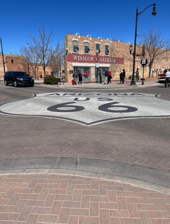
Flagstaff, Arizona.
Don’t forget Winona,
Kingman, Barstow, San BernardinoWon’t you get hip to this timely tip,
When you make, when you make, make that California trip?
Get your kicks on Route 66.–“(Get Your Kicks on) Route 66,” lyrics by Bobby Troup (1)

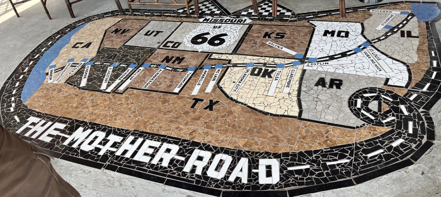
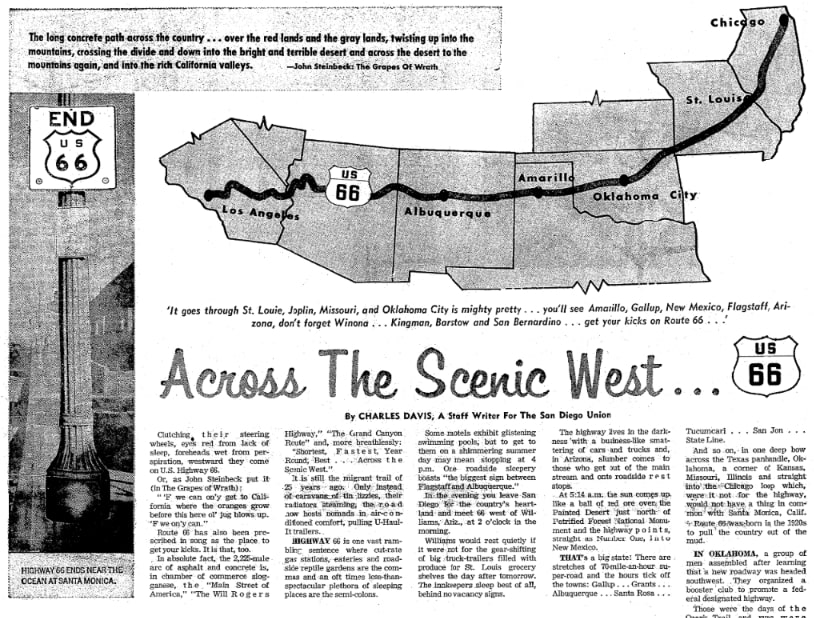
Even if you’ve never driven cross country, chances are you are familiar with a route that travels from Chicago, Illinois, to Los Angeles, California. U.S. Highway 66, also known as Route 66, covers 2,400 miles across the United States. Unlike the famous song that highlights a few of the cities you’ll see along the route, it actually begins at the shores of Lake Michigan across the agricultural fields of Illinois, to the rolling hills of the Missouri Ozarks, through the mining towns of Kansas, across Oklahoma where the woodlands of the East meet the open plains of the West, to the open ranch lands of Texas, the enchanted mesa lands of New Mexico and Arizona, to the Mojave Desert, and finally to the “land of milk and honey” – the metropolis of Los Angeles and the shores of the Pacific Ocean. (2)

The highway dates back to 1926 when “the Bureau of Public Roads launched the nation’s first Federal highway system.” (3) U.S. Highway 66 was part of a new, larger “inter-locking system of uniformly marked highways.” The idea was to make travel easier with marked, numbered highways that took the guesswork out of travel, making it easier for drivers to not get lost. Marked highways were a vast improvement over unmarked roads.

In this 1927 newspaper article, notice that the reader is introduced to the system of highway numbers, where they start and end, and in what general direction they lay.

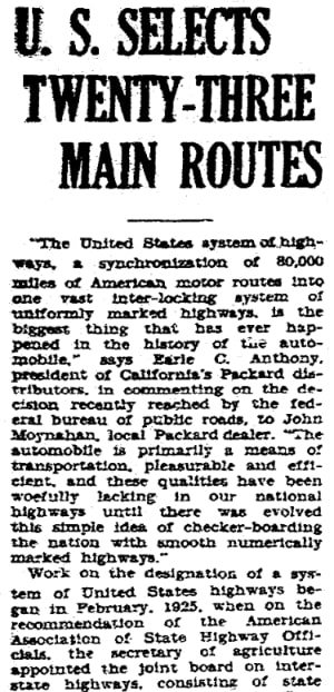
This article reports:
“The United States system of highways, a synchronization of 80,000 miles of American motor routes into one vast inter-locking system of uniformly marked highways, is the biggest thing that has ever happened in the history of the automobile,” says Earl C. Anthony, president of California’s Packard [automobile] distributors, in commenting on the decision recently reached by the federal bureau of public roads, to John Moynahan, local Packard dealer. “The automobile is primarily a means of transportation, pleasurable and efficient, and these qualities have been woefully lacking in our national highways until there was evolved this simple idea of checker-boarding the nation with smooth numerically marked highways.”
Why Did Our Families Use Route 66?
Why is Route 66 so important? For those of us tracing our family history, we need to think in terms of why a national highway that spans nearly the width of the United States would have benefited our families.

The highway was a migratory route. Consider the Great Depression and the Dust Bow-era that saw families go west for opportunities. Families would have used Route 66 to go to California, for example. As the beginning of that highway system mentioned above, it was a clearly marked road with necessities along the way.
Although it was important to migration, those who were part of the U.S. Highway 66 Association had their eye on tourism. They promoted the paving of the route and getting the word out that it was the shortest and most scenic route. They left no doubt that they saw the road as a route to vacationers and other travelers looking to explore the country and spend money.

This article reports:
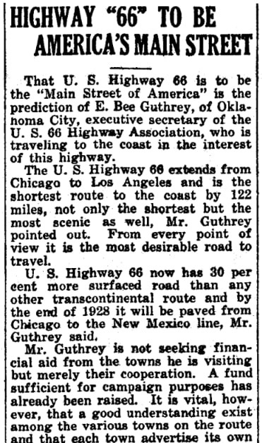
That U.S. Highway 66 is to be the “Main Street of America” is the prediction of E. Bee Guthrey, of Oklahoma City, executive secretary of the U.S. 66 Highway Association, who is traveling to the coast in the interest of this highway.
…Mr. Guthrey is not seeking financial aid from the towns he is visiting but merely their cooperation. A fund sufficient for campaign purposes has already been raised. It is vital, however, that a good understanding exist among the various towns on the route and that each town advertise its own attractions.
Gas rationing during the World War II years would have curtailed the ability to travel, but once the war was over, families used the highway to seek new opportunities and to vacation.

For a time, the highway didn’t just benefit those seeking to migrate – it also financially benefitted rural areas and small retailers who offered hotels, restaurants, and gas to travelers.

This article quotes a passage from John Steinbeck’s The Grapes of Wrath:
“The long concrete path across the country… over the red lands and the gray lands, twisting up into the mountains, crossing the divide and down into the bright and terrible desert and across the desert to the mountains again, and into the rich California valleys.”
What Happened?
Life marches on and other highways and ways to travel meant the end of the popularity of the “Mother Road.” The Federal-Aid Highway Act of 1956 funded the construction of today’s interstate highway system that eventually saw five interstates bypass parts of Route 66. (4) This meant a loss of business for those who took care of travelers along the route. In 1985 Route 66 was decommissioned.
Today, you can travel about 85% of Route 66, or at least get off the interstate highway you are traveling on and drive on some of the old highway. (5) While some of those older businesses still serve travelers and provide nostalgia for those who drive by, others are ghost towns that hint at a busier past.

Interested in traveling in the tire tracks of your ancestors? You can find websites dedicated to helping today’s travelers learn more about Route 66. You might even be able to stop at a restaurant or hotel that they once visited.
Explore over 330 years of newspapers and historical records in GenealogyBank. Discover your family story! Start a 7-Day Free Trial
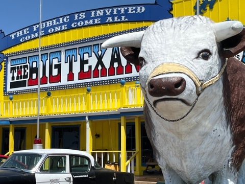
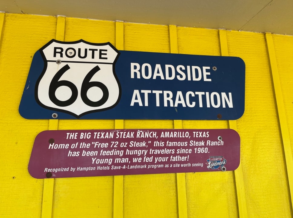
Note on the header image: The Big Texan restaurant, old Route 66, Amarillo, Texas. Credit: Gena Philibert-Ortega.
__________________
(1) “(Get Your Kicks on) Route 66” lyrics by Bobby Troup. These lyrics differ depending on who is singing the song (e.g., “down to Missouri” instead of “Joplin, Missouri”) but Bobby Troup (better known as Dr. Joe Early on the 1970s TV show Emergency 51) wrote the song and I’m quoting his lyrics.
(2) “Route 66 Overview,” National Park Service (https://www.nps.gov/articles/route-66-overview.htm: accessed 14 September 2023).
(3) Ibid.
(4) “Endangered Site: Historic Route 66, U.S.A.,” Smithsonian (https://www.smithsonianmag.com/travel/endangered-site-historic-route-66-usa-52145829/: accessed 14 September 2023.
(5) Ibid.