


Introduction: In this article – part of an ongoing “Introduction to Genealogy” series – Gena Philibert-Ortega writes about a family history source often overlooked by genealogists: historical maps. Gena is a genealogist and author of the book “From the Family Kitchen.”
What’s your favorite map to use when researching your family history? Don’t have one? Maps are an important tool in family history research that is often ignored. In our rush to find our ancestor’s name in a document, we forget to consult reference materials that can enhance and inform our research.
Why would you need a map to do research? Maps help you follow migration patterns, learn more about the place your ancestor lived, determine the location of cities that no longer exist, show changes in county boundaries, and verify land your ancestor owned.
Haven’t thought of using maps before, or not sure what types of maps can help your research? The following can provide you some ideas of what and where to look.
Types of Maps That Help Genealogists
It’s probably obvious that a map showing city or county boundaries is useful to genealogical research, but what other maps should you consider? The FamilySearch Wiki page United States Maps has a few suggestions:
- Atlases
- Historical atlases
- Census maps
- Chamber of Commerce maps
- City and Town maps
- County, Parish or Province maps
- Fire Insurance maps
- Land ownership maps
- Military maps
- Railroad maps
- Topographic maps
Keep in mind that not only are there numerous types of map – but they can contain information that extends beyond the purely geographical. One such example is historical atlases. By perusing my copy of the Atlas of American History (1943), I can study maps that span the history of the United States, including: “Grants to the London and Plymouth Companies of Virginia 1606 and Council for New England 1620”; “The Revolutionary War in the West”; and “Railroads, 1827-1850 Eastern Division.”* These types of maps provide me with important historical information that I can then use as I evaluate records documenting my ancestors’ lives.
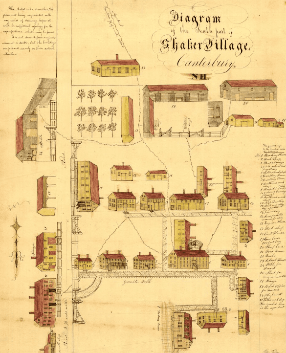
In addition to the maps listed above, one of my favorite types of maps are Bird’s Eye View or Panoramic maps. These maps provide a view of a town from the perspective of a higher elevation. “Although not generally drawn to scale, they show street patterns, individual buildings, and major landscape features in perspective.”**
Online Sources for Maps
Historical maps can be found in brick and mortar repositories like libraries, but there are also large collections found online, including:
- Library of Congress Maps: Use the Search Maps link to search the Library of Congress map collection and narrow your search according to place, collection, date and more. You can also click on Collections with Maps to view collections of maps by topic.
- David Rumsey Map Collection: 79,000 online maps spanning the 16th to 21st centuries.
- University of Texas at Austin Libraries Perry-Castañeda Library Map Collection: 70,000 maps from all over the world – most are copyright free.
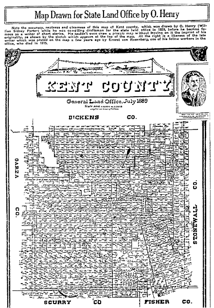
Don’t forget about newspapers in your search for historical maps. A search in GenealogyBank’s Historical Newspaper Archives can find maps that were published in old newspapers. Aside from the familiar weather maps, there can be other types of maps found in historical newspapers like this plat map showing Kent County, Texas, drawn by the author O. Henry prior to his writing career.

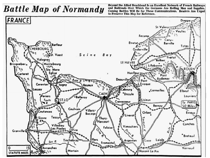
Other maps found in old newspapers detail where events were occurring, such as battle maps. This Battle Map of Normandy is a map that could be used to illustrate the story of your ancestor’s World War II military service.

Find Some Maps!
As you start researching, look for maps that will help you better understand your ancestor’s place and time. Seek out both historical and modern maps to better inform your research. One book that will help you better understand the connection between your genealogy and geography is Walking with Your Ancestors. A Genealogist’s Guide to Using Maps and Geography by Melinda Kashuba (2005). Other books that will enhance your map education include The Family Tree Historical Atlas of American Cities and The Family Tree Historical Maps Book: Europe.
—————————
* Adams, James Truslow. Atlas of American History. New York: Charles Scribner’s Sons, 1943.
** “Panoramic Maps. About This Collection,” Library of Congress (https://www.loc.gov/collections/panoramic-maps/about-this-collection/: accessed 22 August 2017).